01. Node Documentation
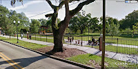
The following is the sequence if images through the district. Gathering areas within the public realm were documented for analysis. A common theme is grouping around the entrance of a local business,with local patrons spending time together in the shade of the building. Public parks were a close second. In this case, the public benches under the 408 overpass along Parramore Ave is being counted as a public park, even though it is simply a shaded area not originally intended for gathering.
02. Mapping
The active spots within the community were plotted by location and meeting place. These areas were translated into nodes and overlaid on top of several maps. Each node is accompanied by an average comfortable walking distance of 1/4 mile (as estimated by Jarrett Walker). The maps were divided into property types to look for patterns which could emerge from the location of activity with neighboring areas. The maps are broken down into residential zones, community-focused areas, and City of Orlando owned property. Property information gathered from Orange County Property Appraisers website.
Community-Focused areas (left), with mapped nodes (right)
City-Owned Property (left), with mapped nodes (right)
Residential Zones (left), with mapped nodes (right)


No comments:
Post a Comment
Note: Only a member of this blog may post a comment.